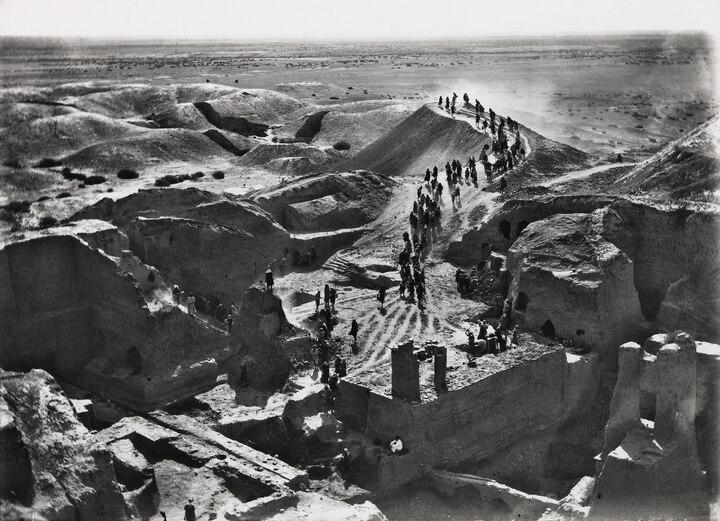
Archaeologists from the University of Pennsylvania began the first full excavation of the Mesopotamian city of Nippur in 1899. This photo from that year was taken atop a pyramid-like ziggurat, near the remains of a temple known as the Ekur.
2025-11-23 387词 简单
No one knows for sure how its creators achieved this level of accuracy—or why, given that ancient people weren’t lugging around stone slabs to navigate. We know Mesopotamians were savvy land surveyors, as other unearthed tablets include detailed renderings of farm fields and housing plots useful for things like tax assessment, says Augusta McMahon, University of Chicago professor of Mesopotamian archaeology and director of the school’s Nippur excavations. But the Nippur tablet covers a far larger area. Its creators likely used rudimentary surveying tools, like knotted ropes and rods, and maybe also a form of trigonometry for calculating angles. But making the map would still have required laborious, incremental measurements and patient tabulation.
免责声明:本文来自网络公开资料,仅供学习交流,其观点和倾向不代表本站立场。